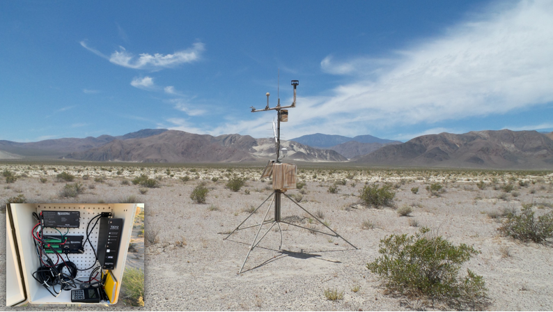
Each weather station in the network is mounted to a 10-foot tripod (Campbell Scientific CM10 tripod) in order to minimalize the amount of ground and visual disturbance. The stations are fully self-contained and powered by a 10-watt solar panel/battery. At the heart of each station, a scientific datalogging device (Campbell Scientific CR1000) controls the data acquisition processes, storage, and telemetry functions. Data from each station in the network is telemetered on an hourly basis, via a GOES satellite transmitter, to the NOAA Wallops Island Command and Data Acquisition Station (Wallops Islands, VA). From there, the hourly data is acquired by the National Interagency Fire Center (NIFC) in Boise, Idaho and then forwarded to the Western Regional Climate Center (Reno, NV) for archiving and public access on a near real-time basis.
Each station is instrumented to measure a standard set of climatological variables including:
- air temperature at 2 meters above the ground (Campbell Scientific HMP-60),
- relative humidity at 2 meters above the ground (Campbell Scientific HMP-60),
- wind speed and wind direction at 10 meters above the ground (Windsonic1 two-dimensional ultrasonic),
- precipitation with stations at Decathon Canyon and Mt. Logan equipped to measure both frozen and liquid precipitation (Campbell Scientific T525 tipping bucket; Geonor T-200 1500 mm all-weather precipitation gauge),
- incoming solar radiation (Campbell Scientific CS-300 pyranometer),
- soil temperature at 2,4,8, and 20 inches (thermocouple wire).